/foblogo.gif)
/redarrow10x4.gif)
/flag.gif) Contact Your Government! |
Aerial Photos of Proposed Mine Site
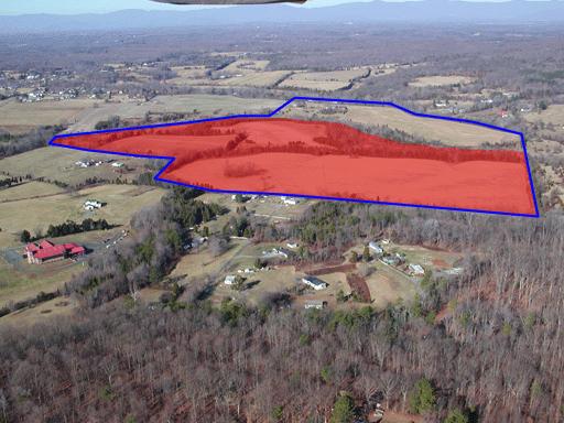
The view above looks north over the site of the proposed mine. The blue outline shows the approximate boundary of the property General Shale wants to buy. The red shading shows the approximate area to be mined. Blue Run, a tributary of the Rapidan River, flows between the shaded & unshaded areas. The unshaded ridge, which fronts on Old Barboursville Road, would be the site of the entrance, the truck wash and other ancillary activities. Although General Shale does not currently propose to mine that ridge, it contains the same Balls Bluff siltstone as the area shaded red, which is the same material General Shale is currently mining in Somerset. The residential area in the foreground is Careytown. The road on the far side is Old Barboursville Road (rt. 738). Although trees hide many of them in this photo, Old Barboursville Road is lined with houses.
For a much larger version of this image, click here. (Note that the file is very large, and may take several minutes to download through a dialup connection.)
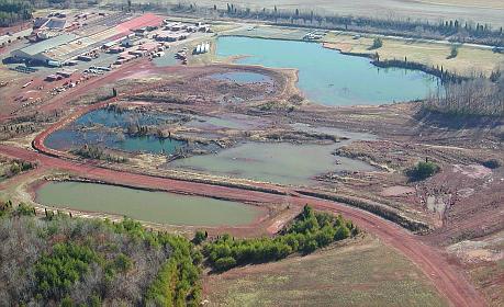
The view above shows the current General Shale site at Somerset. This could
be the way the Barboursville site looks in a few years, if General Shale
is allowed to mine here.
/nomine/brick.jpg)